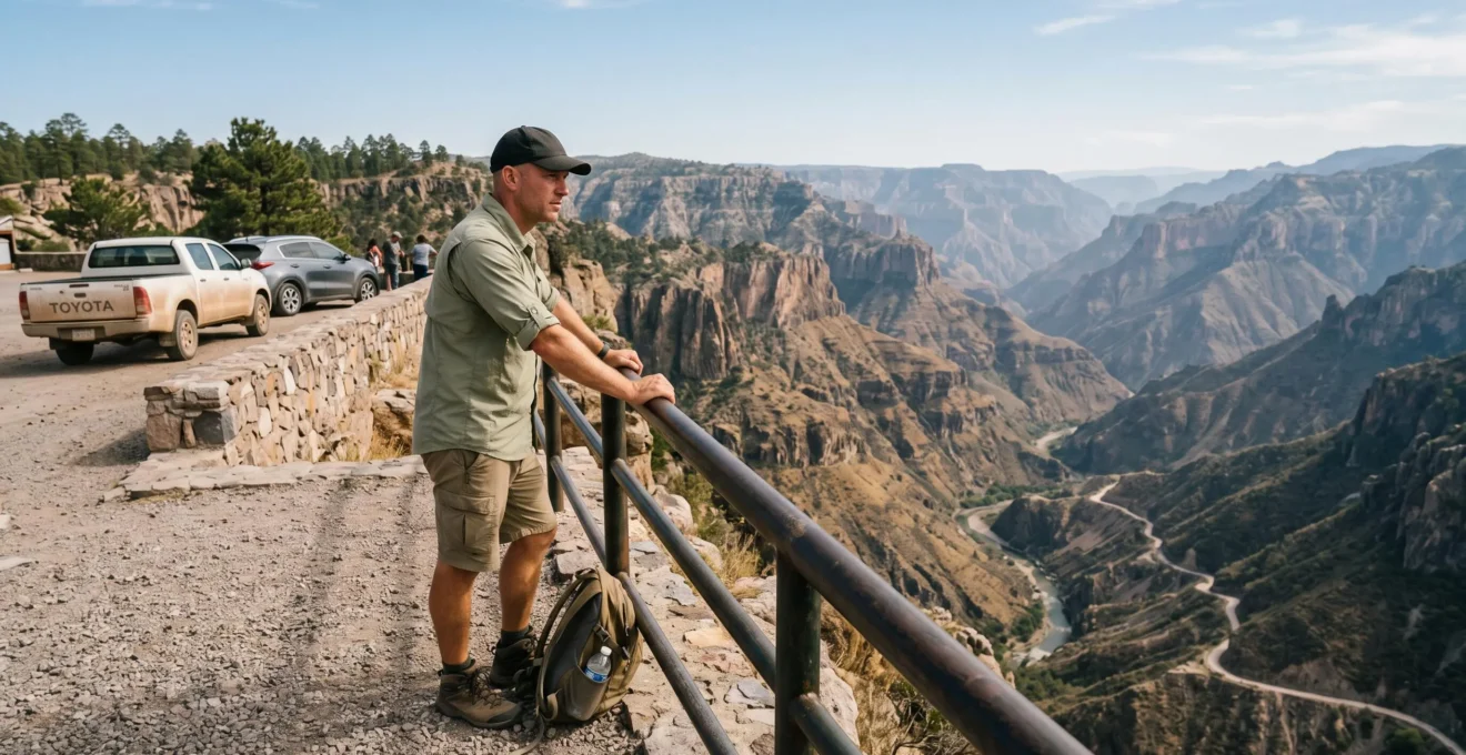
Mexico’s northern canyons offer extraordinary scenery, but reaching the most dramatic viewpoint is not necessarily the best experience for someone prone to travel sickness. A long descent through hairpin bends, an uncomfortable minibus transfer or an overambitious itinerary can turn a memorable landscape into an exhausting day.
The Copper Canyon region of Chihuahua provides several alternatives. Divisadero offers railway access and sweeping canyon views, while more remote destinations such as Cerro del Gallego, Sinforosa and Batopilas involve different road journeys and logistical commitments. The deepest canyon is not automatically the most rewarding choice.
For UK travellers, the practical decision involves four questions: how much winding-road travel is required, whether a train can replace part of the journey, how much time remains for the viewpoint itself, and whether the complete route is appropriate under current travel advice. Choosing fewer stops, a sensible base and a realistic return time can make the difference between enjoying the landscape and merely enduring the journey.
Choosing Mexican canyon viewpoints without an exhausting journey
- Start with access, not depth: Divisadero is a useful first option because the Chepe Express serves the canyon area directly, although onward excursions may still require road travel.
- Limit continuous winding-road exposure: group nearby viewpoints, schedule proper breaks and avoid treating mountain-road distances like motorway distances.
- Protect your return journey: check current road conditions and UK travel advice, establish a daylight cut-off and keep an alternative overnight stop in mind.
- Why Do Canyon Days in Northern Mexico Take 2x Longer Than They Look on a Map?
- How to Plan a Canyon Viewpoint Day With Fewer Hairpin Bends and Better Breaks?
- Which Is Easier on the Body: Canyon Access by Train or by Mountain Road Drives?
- The Canyon Mistake That Leaves Travellers Racing the Dark on a Remote Road
- In What Order Should You Do Canyon Viewpoints to Avoid a 3 pm Energy Crash?
- How to Check if a Mexican Road Is Safe to Drive Before Committing Your Itinerary?
- Which Gives a Better Experience: A Scenic Rail Segment or a Road-Based Canyon Route?
- Why a 100-Mile Drive in Mexico Can Take 4 Hours in One Region and 90 Minutes in Another
Why Do Canyon Days in Northern Mexico Take 2x Longer Than They Look on a Map?
Canyon journeys in northern Mexico often take much longer than their map distances suggest because steep gradients, repeated hairpin bends and variable road surfaces limit driving speeds. There is no reliable universal multiplier: a relatively short mountain section may consume more time than a much longer journey across the plains, especially when viewpoint stops and slower vehicles are involved.
The Sierra Tarahumara is a particularly clear example. Mountain roads negotiate ridgelines, descend into valleys and climb towards settlements, often covering considerably more ground than the straight-line distance between destinations suggests. A driver cannot maintain the speeds possible on northern Mexico’s more open highway corridors.
The Chihuahua state government‘s description of the region gives an indicative journey of approximately 304 kilometres and six hours between Chihuahua city and El Divisadero or Posada Barrancas. That is a route-specific estimate, not a speed to apply to every mountain road.
304 km / approximately 6 hours
Indicative road distance and journey time from Chihuahua city to El Divisadero or Posada Barrancas, as reported by the Chihuahua state government. Actual conditions can change the duration.
Chihuahua government’s overview of canyon viewpoints and access routes
For a more reliable itinerary, divide the journey into individual sections. Identify the slowest mountain stretch, use its own estimated driving time and add separate allowances for viewpoints, traffic delays and rest stops. Avoid calculating the whole day’s duration from an average speed achieved on faster approach roads.
This matters particularly when motion sickness is involved. Slow progress through repeated curves can mean a prolonged period of uncomfortable movement, even when the actual distance is modest.
The same caution applies to railway planning. Chepe Express journeys cover a substantial part of the day, and passengers must work around fixed station times rather than assuming a quick transfer between attractive places. Railway distances alone cannot tell you how much time will remain for an excursion.
A comfortable canyon day is built around the slowest part of the route, not its most convenient stretch. Once that section is accounted for, choosing suitable viewpoints becomes easier.
How to Plan a Canyon Viewpoint Day With Fewer Hairpin Bends and Better Breaks?
The easiest way to reduce winding-road exposure is to choose viewpoints reached from the same base or access corridor, instead of attempting several distant canyon rims in one day. Compare each location by road access, elevation and available facilities, then arrange breaks between demanding stretches. Fewer transfers usually make an itinerary easier to manage.
Copper Canyon is not one compact roadside attraction. The wider region contains several different canyon systems, and dramatic photographs do not indicate how difficult each viewpoint is to reach.
Divisadero is a logical starting point for travellers who want panoramic scenery without automatically committing to a deep canyon descent. The railway reaches the viewpoint area, although the exact walking distance, facilities and accessibility of a chosen observation point should be confirmed locally.
For a more selective comparison, use the following planning matrix. Its access descriptions are based on Chihuahua government information, not a clinical ranking of motion-sickness risk.
| Viewpoint area | Access characteristics | Practical consideration |
|---|---|---|
| Divisadero | Railway access to the canyon area; road access also possible | Useful first option when minimising additional mountain-road travel |
| Cerro del Gallego | Travel via Bahuichivo and Cerocahui, with additional local access arrangements | Requires more careful planning of transfers and return times |
| Cumbres de Sinforosa | Approximately 18 km south of Guachochi, according to state tourism information | Best assessed as part of a Guachochi-based visit rather than an ambitious multi-canyon day |
| Batopilas canyon area | Mountain approach involving a substantial descent towards Batopilas | Less attractive for travellers seeking to avoid extended winding-road journeys |
Before committing, check whether the final approach follows a main road or a narrower secondary road. Also confirm the viewpoint’s elevation and whether parking, seating, toilets and protective barriers are actually available. Such facilities cannot be assumed from tourism photographs.
Concentrate stops geographically. Two suitable viewpoints on the same road may be more enjoyable than two famous locations on opposite sides of a canyon system. This avoids repeating the same difficult stretches or spending the day transferring between valleys.
Plan breaks outside the vehicle where stopping is permitted and safe. A pause at a village or established visitor area can be more useful than a brief roadside halt without facilities.
For travellers who become nauseated on an empty stomach, a light, familiar meal before departure may be preferable to skipping breakfast. Avoid assuming that eating a large meal immediately before a winding descent will improve comfort.
Once the viewpoint shortlist is manageable, the next decision is whether to approach the canyon by road or use the railway for part of the journey.
Which Is Easier on the Body: Canyon Access by Train or by Mountain Road Drives?
Train travel may be more comfortable for someone particularly sensitive to repeated road bends, but it is not guaranteed to prevent motion sickness. Mountain driving creates frequent changes in direction, whereas railway travel involves different patterns of movement over a longer period. The better option depends on your individual symptoms, journey duration and any onward road transfers.
Motion sickness is associated with differences between the movement signals perceived by the eyes, inner ear and body. It can affect passengers in cars and trains alike.
The CDC Yellow Book chapter on motion sickness explains that susceptibility varies between individuals. Looking towards the horizon, avoiding reading and limiting unnecessary head movement can help some travellers, although these measures do not eliminate symptoms for everyone.
A road journey through the mountains may involve repeated lateral acceleration as the vehicle follows tight curves. A train may provide a more predictable experience, but continuous movement, curves and changes in speed can still cause discomfort.
Neither transport mode should be described as universally nausea-free.
Chepe Express provides a practical railway approach to Copper Canyon. Its published route connects Los Mochis, El Fuerte, Bahuichivo, Divisadero and Creel. El Fuerte is a western boarding option, while Creel provides an eastern starting point for the Express service.
Travellers approaching from Chihuahua city should distinguish the Chepe Express route from any separate regional railway services. A journey beginning in Chihuahua city should not be assumed to use the same timetable or stopping arrangements as the Express.
Consult the official Chepe Express train timetable before selecting accommodation or booking onward transport. The operator publishes different operating days and times by direction and highlights the time difference between Sinaloa and Chihuahua.
The hidden complication is the last transfer. A train can bring you close to the canyon without delivering you directly to every observation point. For example, accessing the Cerro del Gallego area involves travelling from Bahuichivo towards Cerocahui and arranging the appropriate local excursion.
Before buying tickets, establish whether a viewpoint can be reached on foot from the station or requires a shuttle, minibus or separate guided journey. Ask about road surfaces, journey duration and stops rather than accepting a generic description such as a short transfer.
For someone who tolerates trains better than winding roads, Divisadero may be a particularly sensible first canyon destination. Its value lies in the combination of impressive scenery and manageable access, not in a promise that the journey will be symptom-free.
The Canyon Mistake That Leaves Travellers Racing the Dark on a Remote Road
The mistake is leaving the final viewpoint without enough time to return before darkness. A seemingly short mountain journey can take longer than expected because of steep roads, slow vehicles and changing conditions. On remote canyon routes, that delay may leave travellers navigating bends, unfamiliar road surfaces and limited stopping opportunities after sunset.
The problem usually begins with an optimistic afternoon schedule. A traveller reaches an impressive mirador later than planned but decides to continue because another viewpoint appears nearby on the map. The return journey is then calculated using distance rather than the actual time required on the mountain road.
Once daylight fades, the consequences become more serious. Some rural roads may have little or no street lighting. Animals, uneven surfaces, poorly visible bends and limited services can make an unfamiliar journey more difficult.
Driving faster to recover lost time is not an acceptable solution, especially when passengers are already nauseated or the driver is tired.
A safer planning method is to calculate the departure deadline backwards from the expected end of usable daylight.
- Identify the time by which you intend to reach your accommodation or a suitable overnight stop.
- Check the estimated travel duration for the actual return route, not a straight-line distance.
- Add a contingency allowance for delays, stops and slower traffic.
- Set a latest departure time from the final viewpoint.
- Cancel the last stop or use a prearranged alternative if that departure time can no longer be met.
For example, imagine a hypothetical afternoon in which the estimated return drive is two hours and you have allowed another hour for uncertainty. You would need to leave at least three hours before your chosen arrival deadline. This is a planning illustration, not a verified travel time for a particular Mexican road.
Identify a realistic fallback village or accommodation option in advance. A name appearing on a map does not establish that rooms, fuel or transport are available there.
It is also important to distinguish road-navigation concerns from regional security conditions. A route that looks physically manageable may still fall outside an area covered by UK government travel-advice exceptions.
A fixed departure time makes the day’s remaining choices simpler. The next step is ordering the stops so that physical fatigue and the most demanding driving do not accumulate together.
In What Order Should You Do Canyon Viewpoints to Avoid a 3 pm Energy Crash?
For many motion-sensitive travellers, a sensible canyon day begins with the most demanding journey and leaves easier viewpoints for later. This is a practical scheduling strategy rather than a medically established rule about 3 pm. By protecting the middle of the day for food, rest and shorter transfers, you reduce the chance of facing difficult roads when already fatigued.
Several factors can overlap during a canyon excursion: repeated vehicle movement, interrupted sleep, dehydration, unfamiliar meals and the effort of spending hours away from comfortable facilities. Higher elevations and variable daytime temperatures may add to the demands of the visit.
They do not affect everybody in the same way. There is no established universal afternoon energy crash, and motion-sickness research does not identify one ideal time of day for all canyon journeys.
Nevertheless, front-loading the hardest section gives the rest of the itinerary greater flexibility. Travellers can then reduce or cancel optional stops without sacrificing the main objective.
A manageable sequence might look like this:
- Early morning: eat a suitable breakfast, check road information and complete the most demanding planned transfer while alert and rested.
- Late morning: visit the principal viewpoint, with enough time to enjoy it without rushing.
- Midday: stop in a settlement, railway station area or established visitor location with suitable facilities.
- Early afternoon: choose a nearby viewpoint requiring relatively little additional driving, or remain at the base.
- Later afternoon: return along the prechecked route before the agreed deadline.
Place the midday break somewhere identifiable rather than vaguely planning to stop when needed. Around Creel, Divisadero or Cerocahui, verify the facilities and opening arrangements for the particular stop you intend to use.
If your accommodation is already close to Divisadero, there may be no reason to undertake a demanding morning drive at all. In that case, a short visit followed by an extended rest could be preferable to a more elaborate sightseeing circuit.
For anyone relying on motion-sickness medication, discuss appropriate options with a pharmacist or clinician before travelling, particularly where drowsiness could affect driving or participation in activities. Medication should not be tried for the first time just before a demanding journey without understanding its effects.
Good pacing makes the visit more enjoyable, but it cannot compensate for an unsuitable or unsafe road. The route itself still needs a separate check.
How to Check if a Mexican Road Is Safe to Drive Before Committing Your Itinerary?
Check a Mexican canyon road at three levels: its route and surface characteristics, recent information from people familiar with the area, and conditions immediately before departure. For UK travellers, also check whether the entire journey is compatible with current FCDO advice. A road appearing on a navigation app does not establish that it is suitable or advisable to use.
Start by identifying the road category. Mexican cuota roads are toll routes, while libre roads are free alternatives. The distinction can affect journey time, but neither label guarantees a particular road surface, traffic condition or security situation.
Mountain routes require closer attention than broad regional maps usually provide. Check the road’s geometry and elevation changes, the presence of long descents and whether the final approach becomes a narrow local road.
Compare journey estimates from more than one mapping tool, then ask your accommodation provider, a reputable local operator or another appropriate local contact about the specific section. Recent first-hand information is particularly valuable where roadworks, weather damage or temporary closures may affect travel.
During rainy periods, mountain routes can be affected by reduced visibility, debris or landslide-related disruption. Do not assume that a route described in older tourism material still has the same surface or operating conditions.
Security is a separate and essential consideration. The UK Foreign, Commonwealth & Development Office’s Mexico advice, updated on 20 October 2026 in the supplied source information, distinguishes the Copper Canyon railway corridor and certain named roads from broader warnings affecting Chihuahua and Sinaloa.
These exceptions do not automatically extend to every side road or distant viewpoint. The UK government’s Mexico travel advisory should be checked for the precise route, including any road excursions away from the railway corridor. Travelling against FCDO advice may affect insurance cover, depending on the policy.
Five checks to complete before booking a canyon road day
- Map the complete route: save a route showing the start, destination, return journey and every planned connecting road.
- Compare the slow sections: produce a short list of mountain segments with individual travel-time estimates from more than one mapping tool.
- Check official travel advice: record the current FCDO guidance covering each planned corridor and identify any sections outside relevant exceptions.
- Confirm recent local conditions: obtain a dated response from an accommodation provider or reliable local operator about road surfaces, disruptions and available transport.
- Prepare the fallback: record an alternative route or suitable overnight stop, together with the latest acceptable departure time.
Repeat the final checks shortly before setting out. A route can become unsuitable after an itinerary has been booked, and changes in official travel advice or local conditions should take precedence over an existing sightseeing plan.
If a connecting road cannot be verified or falls outside appropriate travel-advice conditions, reconsider that destination rather than treating uncertainty as an ordinary travel inconvenience. A shorter itinerary may offer a better experience.
Which Gives a Better Experience: A Scenic Rail Segment or a Road-Based Canyon Route?
A scenic railway segment is often the more straightforward choice for travellers who value predictable schedules and want to limit mountain-road driving. A road-based route provides greater freedom to select viewpoints and control stopping times, but can involve more complex access and longer winding sections. Neither is inherently superior: the best experience depends on comfort, available time, budget and preferred stops.
The Chepe Express offers an established route through the Sierra Tarahumara, serving important access points including El Fuerte, Bahuichivo, Divisadero and Creel. For travellers who want a substantial canyon experience without planning an extensive driving circuit, a suitable rail segment can be appealing.
However, the idea that a train always provides the best view is too simplistic. Much depends on the segment travelled, the weather, seating and whether the traveller wants a broad experience of changing mountain scenery or time at a particular canyon rim.
A road itinerary offers the advantage of stopping at selected viewpoints where access is permitted. It may also make it easier to spend extra time in a village or adapt the programme to changing energy levels.
The disadvantages are equally important: uncertain travel times, more difficult roads, navigation responsibilities and potentially greater exposure to repeated bends.
| Decision factor | Scenic rail segment | Road-based route |
|---|---|---|
| Motion tolerance | A different movement pattern that some travellers may find easier | Greater exposure to repeated curves on winding roads |
| Time available | Fixed departures and station schedules | Flexible stopping times, but potentially lengthy transfers |
| Budget | Train tickets plus any station transfers or accommodation | Vehicle, driver or tour costs, with applicable fuel and toll expenses |
| Intermediate stops | Limited by station calls and ticket arrangements | More choice where road access and local conditions permit |
Costs should be compared using actual quotations for the planned dates. A rail ticket may not include onward transport, while a road trip may involve expenses beyond the headline car-hire or excursion price.
A hybrid itinerary can be particularly effective. For example, a traveller might choose a Chepe Express segment that includes Divisadero, stay locally and arrange only one carefully selected viewpoint excursion rather than an extensive road circuit.
This still requires confirming railway times, accommodation, transfers and current travel guidance. It should not be assumed that every station provides convenient car hire or readily available shuttle services.
A memorable canyon experience is measured less by the number of viewpoints completed than by whether the journey leaves enough energy to appreciate them. That principle also applies to the wider Mexican road trip.
Key takeaways before planning the wider route
- Distance is not a consistent measure of effort: separate highway mileage from slow mountain-road sections in your itinerary.
- A faster road may justify its toll: compare the complete journey time and route suitability, not just the apparent savings on the map.
- Give canyon days their own space: avoid relying on fast driving elsewhere to compensate for an overloaded mountain itinerary.
Why a 100-Mile Drive in Mexico Can Take 4 Hours in One Region and 90 Minutes in Another
A 100-mile drive in Mexico can take very different amounts of time because road design, terrain, traffic and speed restrictions vary substantially. Broad toll highways may allow relatively uninterrupted progress, whereas mountain roads and local routes can require repeated slowing. The four-hour and 90-minute figures illustrate this contrast; they are not guaranteed times for specific journeys.
Across parts of northern Mexico’s plateau and major transport corridors, long distances may be covered on relatively direct roads. On suitable highways, gradients and curves can be less restrictive than in the Sierra Tarahumara.
Mexico’s cuota network generally refers to toll roads, while libre routes are free alternatives. A free road may pass through settlements, include intersections or feature speed humps known locally as topes. Such interruptions can significantly affect travel time.
However, a toll road is not automatically faster on every journey. Its location, roadworks, traffic conditions and suitability for the actual destination still matter.
In canyon country, the geography changes the calculation. Mountain roads follow slopes, negotiate repeated bends and may involve lower-speed sections that cannot be treated like open highway mileage.
Consider a hypothetical 100-mile journey, equivalent to approximately 161 kilometres. One route might be mostly on a suitable, uninterrupted highway and take around 90 minutes. Another might include demanding mountain driving and settlement crossings, taking four hours. These are illustrative scenarios, not measured timings from verified Mexican routes.
The planning implication is to divide your full holiday route into different driving environments:
- Main highway corridors: estimate using the actual road category, traffic and applicable speed restrictions.
- Secondary roads: allow for village crossings, intersections and variations in road quality.
- Sierra approaches: estimate each mountain section separately and include practical stops.
- Viewpoint access roads: confirm local conditions before including them in the day’s schedule.
A long but straightforward highway transfer and a short winding canyon descent should never be treated as equally demanding merely because a navigation app presents both as simple driving instructions.
Similarly, choosing between a cuota and a libre route should involve time, fatigue, road conditions, official travel advice and the suitability of the complete journey, not just the toll charge.
For an itinerary that includes Copper Canyon, the most effective approach is to allocate the canyon region sufficient time from the outset. Avoid building an ambitious multi-stop journey and assuming that missed hours can be recovered by driving faster later.
Choose one primary canyon viewpoint or rail experience, confirm the full access route, and build the surrounding days around realistic journey times. If the road or transfer proves unsuitable, changing the viewpoint is a better decision than pushing through discomfort to complete the original plan.
Can you visit Copper Canyon without taking a long winding road?
Yes, the Chepe Express provides railway access to the Divisadero canyon area. This can reduce the need for an extended mountain-road approach, although some accommodation and individual viewpoints may still require a road transfer. Confirm the final connection and current railway schedule before booking.
Is a deeper canyon necessarily harder to visit?
No. Canyon depth does not determine journey difficulty. What matters for a motion-sensitive visitor is the access road, time spent travelling, viewpoint elevation, available facilities and whether a local transfer is required. A spectacular panorama from a comparatively accessible rim may be more enjoyable than a journey deep into a canyon.
What can help reduce motion sickness during a canyon transfer?
Looking towards the horizon when possible, avoiding reading and minimising unnecessary head movement may help. Symptoms and effective strategies vary by person. If medication is being considered, seek advice from a pharmacist or clinician before the trip, especially if you may need to drive afterwards.
Should you book a canyon excursion before checking UK travel advice?
No. Check the current FCDO advice for every state, road and connection involved, including excursions beyond the main Copper Canyon railway corridor. An exception covering a railway destination does not automatically cover a remote side road. Review travel insurance conditions as well, since travelling against official advice may affect cover.
Is it better to stay overnight near a viewpoint rather than make a day trip?
An overnight stay can be worthwhile when it avoids repeating a lengthy mountain transfer or removes pressure to travel after dark. For a motion-sensitive traveller, a suitable base near the chosen viewpoint may provide more rest and fewer demanding journeys. Confirm accommodation availability, local transport and the security implications of the complete route before committing.