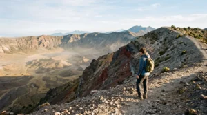
Mexico’s volcanic landscapes can be accessible to ordinary walkers, but reaching a crater viewpoint is not necessarily comparable to climbing a familiar hill in Britain. High altitude, loose volcanic terrain, unpredictable mountain conditions and difficult road access can turn an apparently short excursion into a demanding day.
For UK travellers without extensive mountain experience, a short, officially accessible crater viewpoint walk is generally a more realistic objective than a complete rim traverse. Nevado de Toluca is a useful example of a high volcanic destination where the choice between a viewpoint and a longer mountain route can substantially change the demands of the day. However, access restrictions, transport arrangements, weather and individual acclimatisation must be checked before considering any specific route suitable.
The important question is not simply which crater looks spectacular. It is whether the approach, altitude, walking surface, descent and return journey fit your actual capabilities. A shorter outing with enough time to enjoy the scenery can be more rewarding than an ambitious circuit completed under pressure.
Mexican volcano craters: the practical essentials
- Prioritise accessible, authorised crater viewpoints over long rim circuits if you are unfamiliar with high-altitude mountain walking.
- Allow time to acclimatise. Fitness gained on UK hills does not prevent altitude illness at Mexican volcanic elevations.
- Check official access, regional travel advice, weather, transport and turnaround times before committing to a crater day.
- Why Do Mexican Volcano Crater Trips Feel Harder Than UK Hikes of the Same Distance?
- How to Prepare for a Volcano Crater Day in Mexico Without Overtraining for Months?
- Which Gives Better Views: A Short Crater Viewpoint Walk or a Full Rim Hike?
- The Mistake That Turns a Volcano Crater Plan Into a Dangerous Late Descent
- When Should You Schedule Volcano Craters in Your Mexico Itinerary to Reduce Altitude Headaches?
- How to Check if a Mexican Road Is Safe to Drive Before Committing Your Itinerary?
- The Altitude Mistake That Flattens UK Travellers on Their First Highland Day in Mexico
- Why a 100-Mile Drive in Mexico Can Take 4 Hours in One Region and 90 Minutes in Another
Why Do Mexican Volcano Crater Trips Feel Harder Than UK Hikes of the Same Distance?
Mexican crater hikes can feel substantially harder than UK walks of the same length because altitude reduces oxygen availability, while steep volcanic terrain increases physical effort. A 10 km route above 3,000 metres is not equivalent to a 10 km lowland walk. Distance alone cannot capture the additional demands of elevation, loose ground, exposure and limited escape options.
At approximately 3,050 metres, the partial pressure of oxygen available to breathe is about 69 % of its sea-level value. According to the CDC Yellow Book guidance on high-altitude travel and altitude illness, acute exposure at this elevation can reduce arterial oxygen saturation to approximately 88–91%.
This matters when climbing because the body must work with less available oxygen. An uphill pace that feels comfortable in the Lake District may become difficult to sustain on a Mexican volcano. Acclimatisation improves exercise tolerance, but even acclimatised travellers may perform below their sea-level capacity.
69%
At approximately 3,050 metres, inspired oxygen partial pressure is about 69% of its sea-level value. This physiological measure is not a formula for converting walking distance or hiking difficulty.
CDC Yellow Book, 2026 edition, High-Altitude Travel and Altitude Illness.
Terrain compounds the problem. Volcanic ash, scree and loose stones may shift underfoot, particularly on descents. Steeper gradients demand more sustained effort than an equivalent distance on a compacted path. Familiar UK hillwalking grades cannot reliably predict how difficult an unfamiliar volcanic route will feel.
A practical alternative to converting kilometres into an artificial difficulty score is to assess four separate factors:
- Altitude: How high is the trailhead, and how much higher will you climb?
- Terrain: Is the route established and stable, or steep, loose and exposed?
- Commitment: Can you turn around easily, or does the route require completing a long traverse?
- Recovery margin: Will fatigue, weather or a fixed transport departure restrict your descent?
Remoteness also matters. Mobile coverage, ranger presence and rescue arrangements vary by destination and should never be assumed equivalent to those on popular UK walking routes. A manageable ascent can become a serious problem if a walker is exhausted, the weather deteriorates or the return route is unclear.
The safest objective is not necessarily the shortest advertised trail. It is the route whose altitude, surface, exposure and return options leave you enough physical reserve to finish comfortably.
How to Prepare for a Volcano Crater Day in Mexico Without Overtraining for Months?
You do not necessarily need months of intensive training for a short Mexican crater viewpoint walk. Focus on regular uphill walking, sensible pack carrying and realistic pacing in the weeks before departure. More importantly, allow time for altitude acclimatisation in Mexico, because fitness training at sea level cannot reproduce the body’s adaptation to reduced oxygen availability.
Preparation should reflect the planned route rather than a generic mountain fitness target. A short viewpoint approach may be feasible for someone who walks regularly, while a steep ascent on loose ground or a long rim traverse requires substantially greater endurance and movement confidence.
Useful preparation includes sustained uphill walking, repeated local hill climbs or stair sessions, and practice carrying the clothing, water and camera equipment you intend to take. Test your footwear on uneven ground rather than wearing it for the first time at a volcanic trailhead.
There is no evidence in the supplied medical guidance establishing a universal training duration, backpack weight or fitness threshold that makes a crater walk safe. Your preparation should therefore be assessed against the demands of the selected route.
Acclimatisation deserves separate planning. The CDC recommends only mild physical exercise during the first 48 hours at altitude and notes that spending two or three nights around 2,450–2,750 metres before travelling higher provides substantial protection against acute mountain sickness.
Mexico City, at approximately 2,200 metres, can serve as an initial moderate-altitude stop, but time there must not be treated as medically equivalent to sleeping at the elevations specified in the CDC guidance. Higher overnight stops may form part of a gradual itinerary, subject to individual tolerance.
Before committing, consider whether you can sustain an uphill walk, manage a loaded daypack and still have energy for the return. Being able to complete these tasks comfortably is encouraging, but it does not prove that you are acclimatised or immune to altitude illness.
Guided outings can make logistics easier. Vehicle-assisted access to permitted high trailheads around destinations such as Nevado de Toluca or approaches in the Iztaccíhuatl area may reduce the walking required. Nevertheless, reaching a high starting point by vehicle does not remove the physiological effects of altitude, and such access must be verified for the intended date.
A well-chosen viewpoint, supported by gradual altitude exposure and a flexible itinerary, is a more defensible first objective than a difficult summit chosen mainly to justify extensive training.
Which Gives Better Views: A Short Crater Viewpoint Walk or a Full Rim Hike?
A short crater viewpoint walk often provides better overall value for non-expert hikers and photographers than a complete rim hike. It can deliver a dramatic volcanic panorama with less physical effort and exposure. A full rim route may offer changing perspectives, but its longer duration increases dependence on fitness, navigation, stable weather and successful acclimatisation.
The difference is not simply the amount of landscape visible. It is how much time and physical energy remain available to appreciate or photograph it.
For someone primarily interested in crater scenery, a fixed viewpoint may provide sufficient elevation and perspective without requiring a traverse of exposed terrain. Photographers benefit from the ability to settle into a composition, adjust equipment and wait for favourable light.
The following comparison assumes both options are officially accessible and that conditions permit travel. Individual volcanoes may have entirely different route characteristics.
| Decision factor | Short viewpoint walk | Full rim hike |
|---|---|---|
| Fitness demand | Generally lower, depending on altitude and trail conditions | Generally higher because of distance, elevation changes and duration |
| Time commitment | Potentially shorter, with greater flexibility | Longer and more dependent on maintaining a steady pace |
| Photography | More time to compose and wait at a fixed location | More varied perspectives, but less flexibility at individual stops |
| Weather exposure | Usually shorter if the return is straightforward | Extended exposure to changing mountain conditions |
| Navigation | May be simpler on a clearly designated approach | Can require more demanding route-finding |
| Best suited to | Scenery-focused visitors and appropriately acclimatised casual walkers | Experienced, well-prepared hikers with suitable conditions |
Nevado de Toluca illustrates why the distinction matters. Its crater landscape can be viewed from designated approaches when access is authorised. A longer rim objective, however, involves additional physical and navigational demands that should not be inferred from photographs or the apparent proximity of the crater.
Current park regulations and access restrictions determine which routes are permissible. Neither a short viewpoint nor a rim circuit should be assumed open simply because it appears in an older hiking guide.
There is also a photographic trade-off. A long ridge walk might reveal several angles, but cloud, wind or fatigue can arrive before the most interesting viewpoints. A shorter outing gives you more freedom to choose a safe position and concentrate on composition rather than progression.
Golden-hour photography can be attractive, yet it should never justify remaining on exposed terrain after the safe return window. A sunrise outing requires suitable access and safe pre-dawn travel arrangements; an evening shoot requires enough daylight to descend or a properly planned alternative consistent with local restrictions.
For most visitors who want memorable crater images rather than a mountaineering achievement, the viewpoint is the sensible starting choice. The next challenge is ensuring that even this shorter outing ends before conditions become difficult.
The Mistake That Turns a Volcano Crater Plan Into a Dangerous Late Descent
The most consequential scheduling mistake is starting too late or continuing uphill beyond a sensible turnaround time. Afternoon cloud, wind, storms or declining daylight can make volcanic terrain harder to navigate and descend. A fixed turnaround point, calculated before setting out, is more reliable than deciding to descend only after reaching the crater.
High volcanic slopes may be exposed, with limited shelter and loose surfaces that become harder to negotiate when walkers are tired. Mountain weather is variable, and although afternoon deterioration is a planning concern, no particular storm pattern should be assumed for every Mexican volcano or season.
A common error is estimating descent time from an optimistic ascent schedule. Scree, tired legs and reduced concentration can slow the return, while photography stops consume time that may not appear in the original route estimate.
To establish a useful turnaround time, work backwards from the earliest relevant limit: daylight, official site closing time, expected weather changes or the departure of your arranged transport. Subtract a conservative descent allowance and additional time for delays. The result is the latest acceptable point for starting back, not an invitation to continue until the last possible minute.
For example, imagine a hypothetical crater outing with a prearranged vehicle pickup in the afternoon. If your conservative descent estimate and contingency allowance would be compromised by continuing uphill, the correct decision is to turn around, even when the rim appears close.
The turnaround rule must be followed in practice. If the agreed time arrives before the viewpoint, abandon that objective. If weather, visibility or symptoms deteriorate sooner, begin the return earlier.
Transport adds another constraint. A missed shuttle or driver collection can turn a delayed descent into an unwanted journey on unfamiliar mountain roads. Confirm the pickup location and communication arrangements before walking, and do not rely on mobile coverage being available.
Finishing with daylight, energy and reliable transport is part of a successful mountain day. This becomes easier when the crater excursion is placed at the right point in your wider travel itinerary.
When Should You Schedule Volcano Craters in Your Mexico Itinerary to Reduce Altitude Headaches?
Schedule demanding Mexican volcano excursions after a period of gradual altitude exposure rather than immediately after arriving from the UK. Spending two or three nights at an appropriate moderate elevation before ascending higher can reduce acute mountain sickness risk. However, neither a fixed number of days nor good fitness guarantees that a particular traveller will tolerate a high crater route.
Rapid ascent is a central concern. Altitude illness risk is influenced by the elevation reached, the speed of ascent and individual susceptibility. The altitude at which you sleep is especially important, although strenuous daytime excursions to substantially higher elevations can still produce symptoms.
The Government of Canada advice on high-altitude illnesses recommends considering two or three nights at approximately 2,500–3,000 metres before ascending higher. Its guidance also favours sleeping at the lowest practical altitude and making overnight elevation gains gradually.
A sensible itinerary might begin with easy sightseeing after arrival, followed by progressively higher but manageable activities if the traveller remains well. Mexico City, Puebla or the Toluca region may provide useful itinerary bases, although their different elevations and individual travel circumstances must be considered rather than treated as interchangeable.
Where overnight stays rise above 3,000 metres, the CDC recommends limiting increases in sleeping altitude to approximately 500 metres per night, with additional acclimatisation nights as elevation increases. These are sleeping-altitude recommendations, not maximum limits on every daytime excursion.
Weather also affects scheduling. The broadly drier months, roughly November to March, may offer opportunities for clearer conditions on some routes, but weather varies with location and elevation. Cold, snow, ice, wind and access restrictions can still make individual trails unsuitable. A dry-season date is not a safety guarantee.
Reserve flexibility rather than fixing the most demanding volcano for the first available morning. An extra day can be useful if you feel unwell, roads are disrupted or the forecast is unfavourable.
Scheduling the hike later improves your opportunity to adapt and assess conditions. The next decision is whether the journey to the chosen trailhead can be completed safely and reliably.
How to Check if a Mexican Road Is Safe to Drive Before Committing Your Itinerary?
Check both road conditions and regional security before deciding to drive to a Mexican volcano. A route that looks short on a map may include unpaved mountain sections, restricted access or travel-security concerns. Use current official advice, local access confirmation and realistic vehicle information rather than relying on a navigation app alone.
For UK travellers, the FCDO safety and security advice for Mexico recommends travelling during daylight where possible, avoiding isolated roads and using toll roads, known locally as cuotas, whenever practical.
These precautions address personal security, not just the likelihood of encountering potholes. Mexico’s regional risks differ considerably, and official advice for the specific states and areas crossed by your itinerary must be reviewed separately from the road surface.
Start with the complete proposed route, including its final approach to the trailhead. Mapping services can help reveal the broad road layout, while Street View imagery, where available, may show whether a section is paved or unusually narrow. However, imagery can be old, and map applications do not certify that a route is currently safe.
Recent local reports can help identify temporary closures, construction or poor surfaces. Treat traveller forums and social media as supplementary information, not definitive proof. Where possible, confirm access directly with the relevant park authority, accommodation provider or reputable local guide.
Check whether the final approach is suitable for the vehicle you intend to use. A standard rental car may be inappropriate for some steep or rough roads, while a vehicle marketed as four-wheel drive is not automatically suitable for every track. Rental agreements can also restrict unpaved-road use.
Five checks before committing to a volcano trailhead drive
- Trace the complete approach: Save the route showing every state crossed, the final road section and the intended trailhead.
- Review official security guidance: Record the applicable regional travel warnings and any restrictions affecting the journey.
- Confirm physical access: Obtain current information on road surfaces, closures, permitted vehicles and park entry arrangements.
- Validate the transport plan: Record an agreed outward journey, daylight return window and pickup or parking arrangements.
- Prepare a fallback: Write down whether you will postpone, use authorised alternative transport or cancel if the road or weather becomes unsuitable.
A plan B should be genuinely workable. An alternative road is not a safe fallback unless its security, surface and access conditions have also been checked. If the approach becomes uncertain, changing the destination or abandoning the trip may be more sensible than improvising on remote roads.
Reliable transport reduces unnecessary pressure on the mountain day. Yet even a perfectly organised drive cannot compensate for poor altitude decisions once you reach the highlands.
The Altitude Mistake That Flattens UK Travellers on Their First Highland Day in Mexico
The common mistake is assuming that good UK hillwalking fitness means you can immediately handle a demanding Mexican high-altitude hike. British hills are far lower than many Mexican volcanic routes. A fit walker arriving from near sea level may therefore experience breathlessness, headache or nausea on the first high day, even when the walking distance looks manageable.
Ben Nevis, the UK’s highest mountain, reaches approximately 1,345 metres. Mexican volcanic hiking environments can be well above 3,000 metres, exposing visitors to a substantially different physiological challenge.
The body begins adapting after arrival at altitude, but this process takes time. The CDC identifies the first three to five days as particularly important for initial acclimatisation and recommends avoiding excessive exertion during the first 48 hours.
High fitness can make physical tasks easier, but it does not independently reduce susceptibility to altitude illness. Someone accustomed to climbing Scottish Munros can still develop acute mountain sickness when ascending rapidly in Mexico.
Recognising symptoms is essential. A persistent headache after gaining altitude, particularly when accompanied by nausea, dizziness or unusual fatigue, should not automatically be dismissed as dehydration or ordinary exertion. Breathlessness during hard activity can occur at altitude, but unusual breathlessness at rest is more concerning.
If symptoms suggest altitude illness, stop ascending and avoid further exertion while assessing the situation. Do not continue to a higher sleeping altitude while symptomatic. Worsening symptoms call for descent and medical assessment; confusion, difficulty walking normally or breathlessness at rest require urgent attention and descent with assistance where feasible.
Drinking normally helps avoid dehydration but does not prevent acute mountain sickness by itself. Avoid alcohol during the first 48 hours, pace yourself conservatively and keep the initial highland days light.
For someone travelling from the UK, two or three easy acclimatisation days can provide a useful planning framework, but the actual sleeping elevations and personal response matter more than simply counting days.
A successful first highland day may involve little more than an easy walk and careful observation of how you feel. Once the altitude plan is sensible, the final major constraint is how long reaching the crater will actually take.
Key takeaways before choosing your driving route
- Driving distance is not a reliable measure of how much daylight remains for the hike; assess the entire journey and the return.
- Time saved on a suitable toll road can be valuable, but it does not replace region-specific security and access checks.
- If a lengthy approach prevents a reasonable early start, consider staying nearby or selecting a different authorised viewpoint.
Why a 100-Mile Drive in Mexico Can Take 4 Hours in One Region and 90 Minutes in Another
A 100-mile journey in Mexico can take very different amounts of time depending on road type, terrain and traffic conditions. Modern toll roads may allow relatively direct travel, while rural mountain routes can involve steep bends, towns, speed bumps and slow vehicles. For volcano trips, realistic driving time matters more than distance because it determines whether an early, safe walking window is possible.
Mexico has major toll-road connections, known as cuotas, as well as free roads, often called libres. The difference can be substantial when planning a journey between a city and a mountain destination.
Toll routes may offer better surfaces, fewer interruptions and faster progress on some corridors. Free roads can pass directly through settlements and include topes, or speed bumps, along with junctions, agricultural vehicles and slower local traffic.
Neither road category guarantees a particular journey time, and the hypothetical 90-minute and four-hour durations in this comparison should not be treated as verified estimates for any named Mexican route.
Mountain topography creates another source of delay. A trailhead located close to a city in straight-line distance may require a lengthy ascent on winding roads. Sections that appear insignificant on a map can become decisive if the surface is rough or the vehicle must travel slowly.
To estimate travel time, compare available road options in a navigation service and examine the actual route rather than the direct distance. Add a practical allowance for roadworks, fuel, food stops, toll payments and the final approach. Recheck conditions close to departure.
The toll-versus-free-road choice also has a cost dimension. Toll charges vary by route and vehicle, so obtain the applicable amounts before travel rather than assuming a standard price. A faster road may justify the expense when it helps preserve daylight, although security risks must still be assessed independently.
For crater itineraries, work backwards from the desired trailhead arrival. If reaching the volcano requires several hours of road travel, an overnight stay closer to the permitted access point may allow a more comfortable morning departure. That accommodation should itself be assessed for location, security and suitability.
Where a short drive allows an early start without unsafe night-time travel, a day trip may be reasonable. If the only workable schedule involves travelling on unfamiliar roads in darkness or rushing the descent to beat traffic, reconsider the plan.
Choose a crater viewpoint only after confirming that its walking demands, altitude, access permissions and round-trip transport fit together. A practical next step is to shortlist an authorised viewpoint, check current local conditions and build a flexible itinerary that protects both acclimatisation time and the daylight return.
Can you visit a Mexican volcanic crater without climbing to the summit?
Potentially, yes. Some volcanic destinations offer designated viewpoints or approaches that do not require a complete summit climb or rim traverse. Nevado de Toluca is one destination worth investigating, but access rules can change and a shorter route may still begin at very high altitude. Confirm current permissions, the trailhead elevation and the actual walking requirements before booking.
Is a guided crater excursion automatically safe for beginners?
No. A reputable guide may improve navigation, route selection, transport coordination and local decision-making, but cannot eliminate altitude illness, unstable terrain or severe weather. Ask about maximum elevation, expected exertion, group size, emergency arrangements and the conditions under which the outing will be cancelled or shortened.
Can you take a camera and tripod on a short volcanic viewpoint walk?
Photography equipment may be practical on an accessible viewpoint route, subject to local regulations. Keep the load manageable, use stable ground away from exposed edges and confirm whether tripods are permitted. A shorter objective can leave more time for composition without creating pressure to complete a long rim walk.
Does sleeping at a lower altitude make a high crater day trip risk-free?
No. Returning to sleep at a lower elevation generally creates less physiological stress than spending the night at the higher destination, but symptoms can still develop during a rapid daytime ascent. The appropriate decision depends on acclimatisation, individual susceptibility, exertion, symptoms and the maximum elevation reached.
What should you do if the crater trail is closed on the day of your visit?
Respect the closure and do not attempt an informal alternative entrance or unverified route. Ask the responsible authority or reputable local operator whether another authorised viewpoint is available. If not, postpone the excursion or choose a different activity. A closure may reflect safety, conservation, volcanic activity or access-management concerns that are not visible from the road.